


Predicting wild boar abundance using game bag data
Knowing the distribution, abundance and population density of wild boar and predicting its evolution over time are key to managing and minimizing its overabundance 15 November 2023
 3 minute read
 By:
By: A study demonstrates the predictive capacity of the spatial models of relative abundance of wild boar, generated in 2014 from the data of the hunting bags (number of reported animals killed), comparing them with current hunting bags of the species.
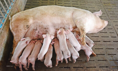
Wild boar (Sus scrofa) is a widely distributed wild ungulate involved in numerous conflicts with humans, the conservation of other species, and public health. In order to make decisions regarding their management, reliable estimates of their abundance are necessary, and in this sense spatial modeling has become the most widely used option to determine how abundance is distributed on a large scale. Game bags have been a widely used data source for this, but very few studies have evaluated the real predictive capacity of models based on these data. a posteriori on new time series and/or territories.
Scientists from the Research Group in Health and Biotechnology (SaBio) of the Instituto de Investigación en Recursos Cinegéticos (IREC – CSIC, UCLM, JCCM) have tested the predictive capacity of wild boar abundance of the previously generated explicit spatial models (2014) for the different bioregions of Spain (according to the Surveillance Scheme for the Monitoring of Wildlife Diseases) based on data from hunting bags, as well as its transferability to territories for which there were no data. To do this, they have projected the models created in 2014 in a total of 13.807 hunting grounds and have compared the abundances predicted by the models with the hunting bags obtained between the 2014-2018 seasons.
The predictive models generated in 2014 were parameterized from wild boar hunted annually per 100 km2 as a response variable and a set of 21 bioclimatic variables used as predictors. The data available for the creation of the models covered approximately 60% of the surface of mainland Spain. and later extrapolated to predict wild boar abundance also in unsampled territories.
In this studio, the previous models were used to predict wild boar abundance at the hunting ground level, generating predictions both for areas in which the models were calibrated (interpolation areas) and for areas where there was no data in the 2014 models (extrapolation areas). From recent data on wild boars hunted at the hunting ground level, the relative abundance observed was calculated (wild boars hunted/100 km2), which was used to evaluate the predictive performance of the previous models.
For the comparison between the relative abundances recently observed and those predicted by the models, visual inspections of the cartography produced were carried out, calibration plots were obtained and Pearson correlations were calculated.
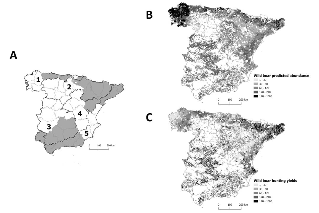
The results show that spatial models generated in 2014 were able to forecast current general patterns of relative abundance of wild boar, evidencing growth rates equivalent to those reported by other authors, although their performance varied between bioregions. The predictions in interpolation areas were better than those obtained for the extrapolation areas, and the precision of the predictions decreased as the spatial resolution of the same (hunting ground) increased.
This suggests that spatial models generated from game bags can predict general patterns of the distribution of relative abundance of wild boar, which represents a significant advance in the use of this quantitative information to predict the spatial patterns of relative abundance of game species on a large scale. However, they need a critical evaluation and their application must be done with care, since the models can lose precision when they try to extrapolate to other areas of which there is no information or when they try to obtain predictions at a fine spatial scale. Due to that, differences in hunting effort and performance can alter the results.
It is necessary to continue improving the predictions obtained through this type of model in order to apply them in the preparation of wildlife management plans. From the epidemiological point of view, in the specific case of wild boar, a clear example of its applicability can be found in the prevention strategies of the African swine fever (ASF), since knowledge of the spatial pattern of wild boar abundance would be essential to predict the spread of the disease and to establish effective control measures.